UAV Lidar & Photogrammetry Topography in Texas
UAV Mapping & Photogrammetry Services
Aerial Topography
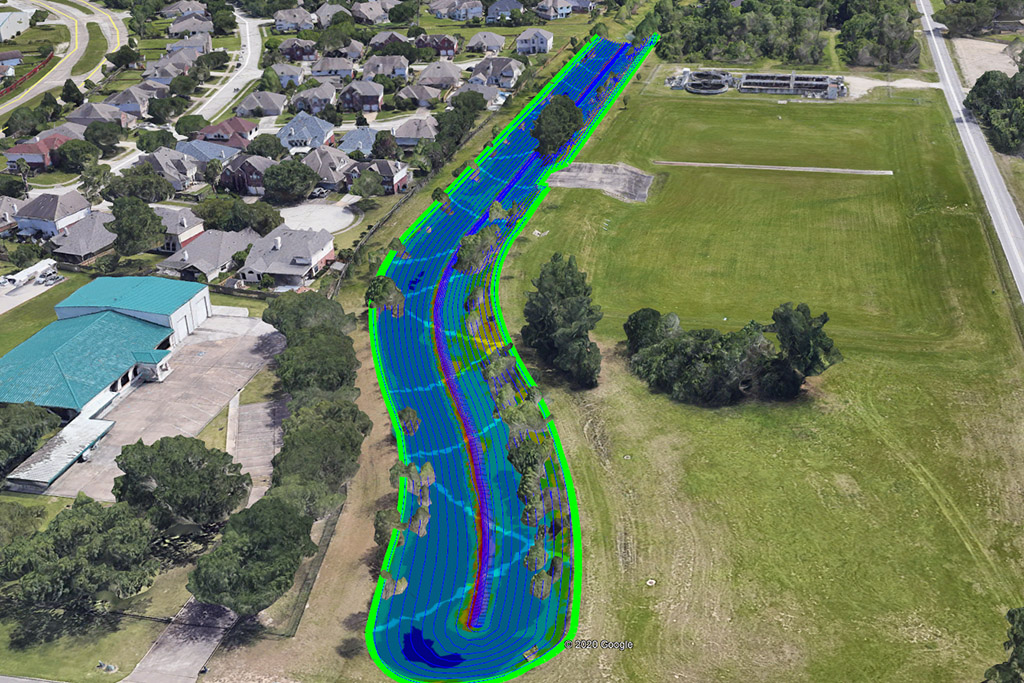
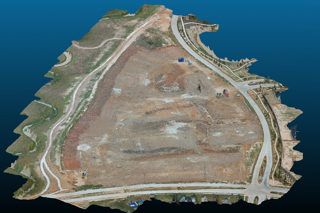
Our LiDAR drone technology delivers highly accurate topographic data, empowering construction and landscaping professionals to plan, analyze, and execute projects with unmatched precision.
Aerial Surveying
Our drones survey your property with pinpoint precision, identifying boundaries, utility lines, and other key site features with exceptional accuracy.
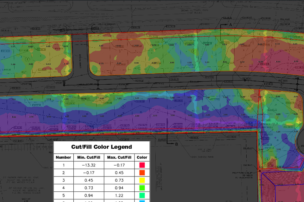
Volume Measurements
Our drones can capture data to the hundredth of an inch; when combined with other data, enables accurate estimation of your material needs.
Site Planning
By leveraging aerial drone imagery and photography, we enable more precise planning and efficient design through accurate, real-world site data.
Experience where it Counts.
Service when it Matters.
Civil Mesh Pro specializes in producing accurate topographic and photogrammetric deliverables while ensuring clients can effectively interpret and utilize their data to its fullest potential.
As emerging technologies continue to reshape the industry, CMP provides expert consulting and engineering services to help organizations seamlessly implement advanced aerial surveying and data collection solutions.